
LiDAR and AI: Revolutionizing Forest Health Monitoring
Published on January 12, 2026 by Admin
The Imperative for Smarter Forestry
National forests are vital. They provide timber, clean air, and water. They also support biodiversity. However, these forests face many threats. Climate change is a major one. Pests and diseases are also serious issues. Deforestation remains a concern in some regions. Therefore, effective monitoring is crucial. Traditional methods are often slow and labor-intensive. They can miss subtle changes. This is where smart forestry comes in. It uses advanced technology. This allows for better forest management.
Introducing LiDAR for Forest Mapping
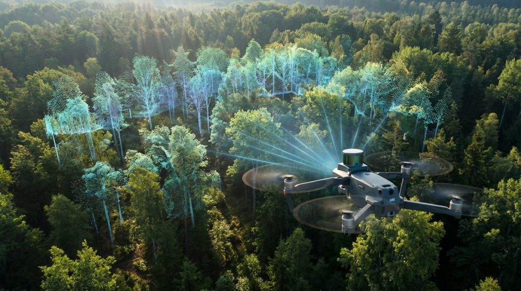
LiDAR stands for Light Detection and Ranging. It is a powerful remote sensing technology. LiDAR uses laser pulses. These pulses are sent from an aircraft or drone. They bounce off the forest canopy and the ground. The time it takes for the pulse to return is measured. This data creates a detailed 3D map. It can show the height of trees. It can also reveal forest density. Furthermore, LiDAR can map the terrain beneath the canopy. This provides unprecedented detail. It allows us to understand forest structure. It helps in identifying different tree species.
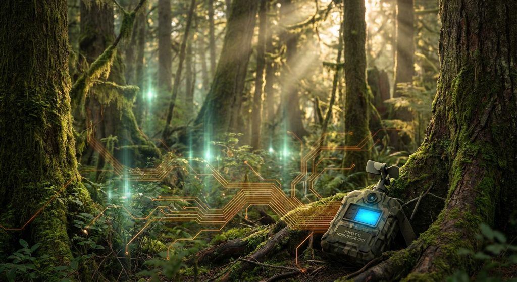
AI: The Brain Behind the Data Analysis
LiDAR generates massive amounts of data. This data needs to be processed. That is where Artificial Intelligence (AI) excels. AI algorithms can analyze LiDAR data quickly. They can identify patterns. For example, AI can detect areas of stress. It can spot signs of disease. It can also quantify biomass. This is a measure of the total plant matter. AI can differentiate between healthy and unhealthy trees. It can predict the spread of pests. Therefore, AI turns raw data into actionable insights. Machine learning models are often used. These models learn from existing data. They improve their accuracy over time.
Key Applications in Forest Health Monitoring
Smart forestry using LiDAR and AI offers many benefits. These tools can track changes over time. This is essential for early detection of problems.
Detecting Disease and Pest Infestations
Diseases and pests can spread rapidly. They can devastate large forest areas. LiDAR can detect subtle changes in canopy health. These changes might indicate stress. AI algorithms can then analyze these anomalies. They can identify specific diseases or pests. For instance, changes in leaf color or density can be detected. This allows for rapid intervention. Early treatment can prevent widespread damage.
Assessing Wildfire Risk and Behavior
Wildfires are a growing threat. Understanding wildfire risk is paramount. LiDAR data can map fuel loads. This includes the density and height of vegetation. AI can use this information. It can predict where fires are likely to start. It can also simulate how fires might spread. This helps in creating better fire management plans. It allows for targeted fuel reduction efforts.
Monitoring Deforestation and Land Use Change
Deforestation continues to be a global issue. Monitoring these changes is vital. LiDAR and AI can map forest cover accurately. They can detect illegal logging activities. They can also track changes in land use. This provides data for conservation efforts. It supports policy decisions. This technology helps in safeguarding forest resources.
Estimating Carbon Sequestration and Biomass
Forests play a critical role in carbon cycling. They absorb CO2 from the atmosphere. LiDAR can accurately estimate forest biomass. This is crucial for carbon accounting. AI can then calculate the amount of carbon stored. This data is important for climate change mitigation. It helps in understanding the forest’s contribution. It supports carbon credit markets. We can learn more about how forests impact climate in articles discussing rainforests’ vital role.
Mapping Biodiversity and Habitat Suitability
Forest health is linked to biodiversity. Different species require specific habitats. LiDAR can map forest structure. This includes canopy layers and undergrowth. AI can analyze this data. It can identify areas suitable for certain species. This aids in conservation planning. It helps protect endangered species. Understanding habitat fragmentation is also key. Technologies like high-tech wildlife corridors can be informed by this data.
The Synergy of LiDAR and AI
LiDAR provides the raw, detailed spatial data. AI provides the intelligence to interpret it. This combination is very powerful. It moves us beyond simple observation. It enables predictive analysis. For example, AI can analyze LiDAR-derived canopy height models. It can then identify areas with stunted growth. This might indicate nutrient deficiencies or water stress. Therefore, a proactive approach to forest management becomes possible.
Challenges and Future Directions
Despite its promise, challenges remain. The initial investment in LiDAR technology can be high. Processing large datasets requires significant computational power. Data quality can be affected by weather conditions. Furthermore, developing accurate AI models requires expertise. Continued research is needed.However, the future is bright. Drone-based LiDAR is becoming more accessible. AI algorithms are constantly improving. Integration with other data sources, like satellite imagery, will enhance insights. We may see real-time forest health monitoring. This will allow for immediate responses to threats. The goal is to create truly dynamic forest management systems. These systems will be more resilient and sustainable.
Frequently Asked Questions
What is LiDAR and how does it work in forestry?
LiDAR is a remote sensing technology that uses lasers to measure distances. In forestry, it’s typically mounted on aircraft or drones. It emits laser pulses that reflect off trees and the ground, creating a highly detailed 3D map of the forest structure, including tree heights, canopy density, and terrain.
How does AI contribute to forest health monitoring with LiDAR data?
AI, particularly machine learning, analyzes the vast amounts of LiDAR data. It identifies patterns, detects anomalies like signs of stress or disease, quantifies biomass, and predicts potential threats like pest infestations or wildfire risks. Essentially, AI turns raw LiDAR data into actionable information for forest managers.
What are the main benefits of using LiDAR and AI for forest management?
The main benefits include early detection of diseases and pests, better assessment of wildfire risks, accurate monitoring of deforestation, precise estimation of carbon sequestration and biomass, and improved mapping of biodiversity and habitat suitability. This leads to more efficient and effective forest management.
Are there any limitations to using LiDAR and AI in forestry?
Yes, some limitations include the high initial cost of LiDAR equipment, the need for significant computational power to process data, potential data quality issues due to weather, and the requirement for specialized expertise to develop and deploy AI models.
How can this technology help in combating climate change?
By accurately estimating forest biomass and carbon stored within forests, LiDAR and AI data provide crucial information for carbon accounting. This helps in understanding forests’ role in mitigating climate change and supports initiatives like carbon credit markets and climate policy development.
Conclusion
Smart forestry, powered by LiDAR and AI, represents a paradigm shift. It offers unparalleled precision and efficiency. By understanding our forests at a granular level, we can protect them better. This technology is vital for ensuring the long-term health and sustainability of our national forests. It empowers forestry officials, environmental engineers, and data scientists with the tools they need. These tools are essential for safeguarding these invaluable natural resources for future generations.