
Real-Time Outbreak Mapping: A Data Science Imperative
Published on February 12, 2026 by Admin
Outbreaks happen. They spread quickly. Understanding them is crucial. Real-time outbreak mapping is a powerful tool. Data science researchers use it to fight disease. It helps us see where outbreaks are. It also shows us how they are spreading. This information saves lives. It guides public health efforts. Therefore, mastering this technology is vital.

The Power of Visualization
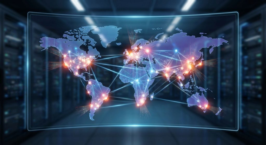
Imagine seeing a disease spread across a map. You see it in real-time. This is the core of outbreak mapping. It turns complex data into a visual story. Data scientists collect many types of information. This includes case numbers. It also includes location data. Furthermore, demographic details are important. Social media data can also be used. Advanced algorithms process this data. Then, they display it on a map. This makes it easy to understand.
For example, early detection of a new virus can be critical. Real-time maps show where the first cases appear. This allows health officials to act fast. They can then implement containment strategies. This is much better than reacting later. Therefore, proactive measures are key.
Key Data Sources for Mapping
Accurate mapping relies on good data. Many sources contribute to this. They include official health reports. These are often from government agencies. However, they can sometimes be delayed. So, other sources are also vital. These include:
- Syndromic Surveillance Systems: These track symptoms. They do this before a diagnosis is confirmed. This provides earlier warnings.
- Social Media and News Monitoring: People often talk about illnesses online. News reports also highlight emerging health issues. Analyzing these can provide early signals.
- Mobility Data: Understanding how people move is crucial. This helps predict where a disease might spread next.
- Environmental Data: Factors like weather can influence disease spread. For instance, mosquito-borne illnesses are linked to rainfall.
In addition, data integration is a major challenge. Bringing together disparate sources requires careful work. It also demands robust data pipelines. Therefore, data scientists must be skilled in data wrangling.
Technological Underpinnings
Real-time mapping uses sophisticated technology. Several key components are involved. These include:
Geographic Information Systems (GIS)
GIS is fundamental. It allows us to analyze and visualize spatial data. Maps are the primary output. GIS software helps layer different data sets. This reveals patterns and connections. It is an essential tool for any mapping project.
Big Data Analytics
Outbreak data is often massive. It is also generated rapidly. Therefore, big data technologies are necessary. These include distributed computing frameworks. They process large volumes of data quickly. This enables real-time analysis.
Machine Learning and AI
Machine learning models enhance mapping. They can predict future outbreak hotspots. They can also identify transmission routes. Furthermore, AI can help process unstructured data. This includes text from social media. As a result, predictive capabilities are greatly improved.
Cloud Computing
Cloud platforms offer scalability. They provide the infrastructure needed. This is for storing and processing vast amounts of data. They also enable widespread access to maps and dashboards. Therefore, cloud solutions are very practical.
Challenges in Real-Time Mapping
Despite its power, real-time outbreak mapping faces hurdles. These must be addressed for effectiveness. Firstly, data quality is paramount. Inaccurate data leads to flawed maps. This can result in poor decisions. Secondly, data privacy is a concern. Location data, for example, is sensitive. Strict protocols are needed to protect it. Moreover, integrating diverse data streams is complex. Different formats and standards can cause issues. Finally, timely access to data is critical. Delays can render the maps less useful. Therefore, collaboration between data providers and researchers is essential.
For instance, when dealing with novel pathogens, data might be scarce initially. This makes early mapping difficult. However, as more data becomes available, the maps become more accurate. Therefore, continuous data collection and refinement are key.
Applications in Public Health
The impact of real-time outbreak mapping is far-reaching. It directly supports public health initiatives. For example, it aids in:
- Early Warning Systems: Identifying potential outbreaks before they become widespread.
- Resource Allocation: Directing medical supplies and personnel to areas most in need.
- Intervention Planning: Informing decisions on lockdowns, testing, and vaccination campaigns.
- Public Communication: Providing clear, visual information to the public about risks and precautions.
- Epidemiological Research: Understanding disease dynamics and informing long-term prevention strategies.
Indeed, during a pandemic, these maps become indispensable. They provide a common operational picture. This helps coordinate global responses. One such effort involves understanding Nipah transmission dynamics. Real-time mapping can help track its spread.
The Future of Outbreak Mapping
The field is constantly evolving. Future advancements will bring even more power. We can expect:
- Greater AI Integration: More sophisticated predictive models.
- Enhanced Data Sources: Incorporating novel data streams. Think wearable device data or genomic sequencing information.
- Improved Interoperability: Seamless data sharing between different systems.
- Democratization of Tools: Making powerful mapping tools accessible to more researchers and organizations.
Furthermore, the integration of “One Health” principles is growing. This approach recognizes the interconnectedness of human, animal, and environmental health. Therefore, mapping efforts will increasingly consider these broader factors. The concept of a One Health strategy is becoming central to pandemic preparedness.
Conclusion
Real-time outbreak mapping is a critical data science application. It empowers researchers and public health officials. It provides actionable insights. This is done by transforming vast amounts of data into understandable visualisations. While challenges remain, continuous innovation promises even greater capabilities. Ultimately, this technology is a vital weapon in our fight against infectious diseases. It helps protect global health. It allows for faster, more informed responses. Therefore, its development and application are of utmost importance.
Frequently Asked Questions (FAQ)
What is real-time outbreak mapping?
Real-time outbreak mapping is the process of using data science techniques to visualize and analyze the spread of diseases as they happen on a geographical map. It helps identify hotspots, track transmission, and inform public health responses immediately.
What kind of data is used in outbreak mapping?
Various data sources are used, including official health reports, syndromic surveillance data, social media activity, news reports, mobility data, and environmental factors.
How does real-time mapping help prevent disease spread?
It allows for rapid identification of new cases and clusters, enabling quicker implementation of containment measures like quarantine, testing, and public health advisories. This proactive approach is more effective than delayed responses.
What are the biggest challenges in creating real-time outbreak maps?
Key challenges include ensuring data quality and timeliness, protecting data privacy, integrating diverse data sources, and developing robust analytical models.
Can anyone create an outbreak map?
While basic mapping can be done with accessible tools, sophisticated real-time outbreak mapping requires specialized data science expertise, powerful computing resources, and access to sensitive data streams. However, the goal is to make these tools more accessible.
How does AI contribute to outbreak mapping?
AI and machine learning are used to analyze complex patterns, predict future outbreak locations, identify transmission pathways, and process unstructured data like text from social media, significantly enhancing the accuracy and predictive power of outbreak maps.
What is the “One Health” approach in relation to outbreak mapping?
The “One Health” approach recognizes that the health of people is closely connected to the health of animals and our shared environment. Outbreak mapping that incorporates this perspective considers factors across all three domains to better understand and predict zoonotic diseases and other public health threats. This aligns with efforts to develop comprehensive pandemic preparedness plans.